Colorize Historical Aerial Photo
Full prompt
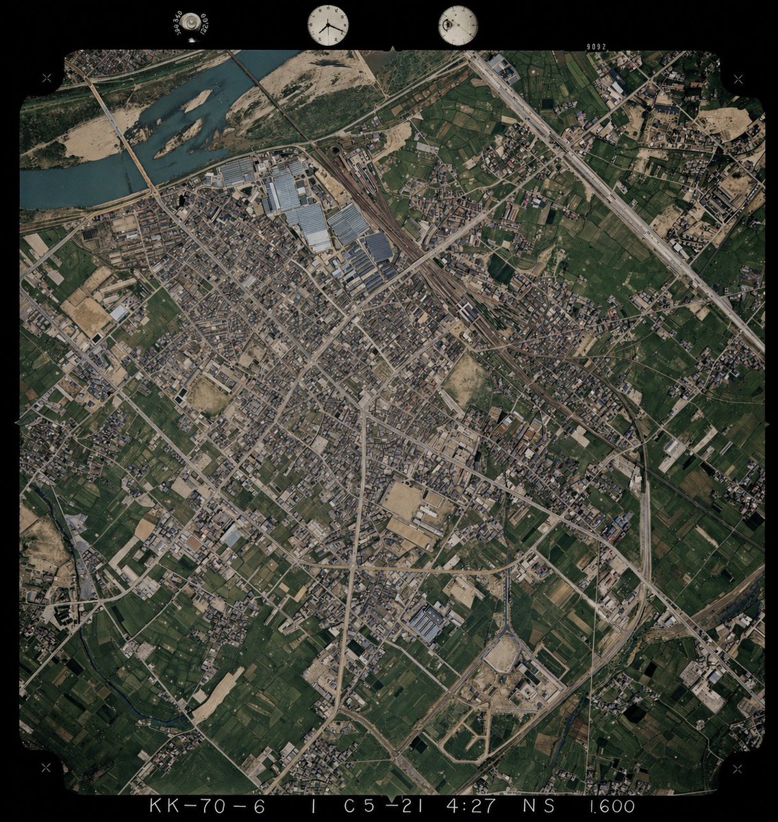
Using REFERENCE_0 as the base image, colorize the monochrome historical aerial photograph while preserving the exact original framing, angle, scale, film border, edge markings, and all geographic structures. Use REFERENCE_1 only as a color-reference guide for plausible land-surface colors seen from above. Keep the old photo’s layout and terrain details unchanged, but infer naturalistic colors for 4 major surface types: river water in muted blue-green, vegetation and farmland in varied dark greens, bare soil/sand and construction areas in tan-beige, and roads/buildings/industrial roofs in subdued gray to light brown. Maintain a realistic archival aerial-photo look rather than a modern satellite style, with slightly restrained saturation, subtle contrast, and consistent coloring across the whole scene.
Use this prompt in the VdoBloom image editor.
Opens the image editor with this prompt — add your own photo to generate.